Summary
The park is bounded to the northwest by Tauferer Ahrn / Valle Aurina valley, by the Austrian border at Staller saddle to the east, by Antholzertal / Valle di Anterselva valley to the southeast and by Pustertal / Pusteria valley to the south.
The Rieserferner-Ahrn / Vedrette di Ries-Aurina Nature Park borders directly on national park Hohe Tauern (Austria). Together with high mountain nature park Zillertaler Alps, these three protected areas with a total area of 2,571 square kilometers constitute Europe’s largest alliance of protected areas. Cross-border initiatives are frequently organized with the goal of promoting the common sense of responsibility for this unique natural and cultural heritage.
The Nature Park, which was established in 1988 and extends over an area of around 10,722 ha, encompasses the villages of Sand in Taufers / Campo Tures, Gais, Percha / Perca, Rasen-Antholz / Rasun-Anterselva, Ahrntal / Valle Aurina and Prettau / Predoi.
The Nature Park is part of the European-wide Natura 2000 sites.
Description
Rieserferner-Ahrn / Vedrette di Ries-Aurina Nature Park – The boundaries of nature and the limits of man
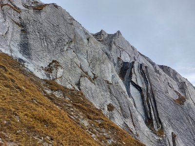
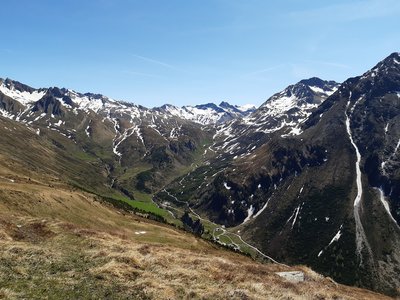
Rieserferner-Ahrn / Vedrette di Ries-Aurina Nature Park has the highest proportion of glaciers of all the nature parks in South Tyrol. “Gletscher”, the commonly employed German term for “glacier”, is relatively new in Tyrol, where people used to say “Ferner” or “Kees” (both of which come from the Zillertal dialect) rather than “Gletscher.
Glacier shrinkage makes it possible to observe glacial formations such as the various types of moraines, erratic blocks, glacial striations, lakes and dome-shaped landscapes. Hence the micro-context of these glaciers allows for observation of the major phenomena that affected large swathes of the landscape at the end of the Ice Age.
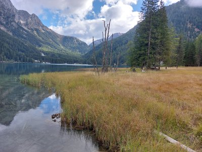
The park’s sparsely populated mountain valleys are surrounded by woods, whereby the predominant tree species is spruce. Montane spruce forests are mostly located at altitudes between 800 and 1,400 m, above which sub-Alpine spruce woods are found. The more sunny and the less dense a spruce forest is, the more permeated it is by larches. There are also scattered deciduous trees such as mountain ashes. Spruces, larches and cembra pines mark the timber line, which is situated at an altitude of 1,900 to 2,200 m. Mugo pines and green alders, the latter in humid areas, make up the knee-timber belt.
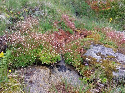
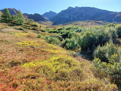
The Alpine lawns above the timber line offer a mosaic of biotopes for numerous species of mountain wildlife. Marmots, which find sufficient grasses and herbs to feed on, are the main source of food for golden eagles, which regularly nest in the park. The water pipit is a characteristic bird of Alpine pastures. On meadows carpeted with flowers numerous insects such as butterflies, beetles, bumble-bees and grasshoppers can also be found.
The park is part of the European-wide Natura 2000 sites, which aim to promote habitat, flora and fauna conservation and were established under the EU’s FFH Directive (92/43/EC) and Bird’s Directive (2009/147/EC).